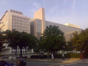
World Bank Headquarters; photo courtesy of Panoramio user Jaakko H., CC BY-SA 3.0.
On March 14, 2016, at 7:55 a.m., the spotlights brighten and focus on the unoccupied chairs of the panel in the World Bank’s Preston Auditorium. Officials from over 100 countries shuffle to get into their seats, exchanging greetings and cordialities in over 90 languages. A line of delegates floats to the panel as the audience—an ocean of suits, government pin flags, and private-sector logos—settles down. Asli Demirgüç-Kunt, Director of Research in the World Bank, says, “Your excellences, ministers, honorable guests, welcome to the 17th Annual World Bank Conference on Land and Poverty.”
Held at the World Bank Headquarters in Washington, D.C., the World Bank Land and Poverty Conference 2016 focused on the theme, Scaling Up Responsible Land Governance. The conference consisted of a 5-day series of in-depth lectures on the topics of land governance, land tenure, and the technologies associated with them.
The Land Governance Assessment Framework
Countries from various economic backgrounds and cultures carried out the Land Governance Assessment Framework (LGAF), a diagnostic instrument developed by the World Bank and its partners to assess the status of land governance at the national level. The LGAF uses a highly participatory panel process to produce a ranking based on a comprehensive review of available conceptual and empirical material by local experts in land governance. The LGAF is intended to document key information on land governance and develop actionable policy recommendations to suit the local context.
Each country’s LGAF findings revealed gaps in the ability to implement land governance and tenure due to administrative, technological, and social issues. While the contributing factors to these gaps in land governance vary by unique circumstances of corruption levels, social characteristics, and geopolitical instances, there were overwhelming common trends in land governance issues. The most prominent of these issues relate to data.
Inadequate Data Archiving and Access

Dr. Clifford Lipscomb and Nawaf Alfaouri attending the World Bank Land and Poverty Conference. Photo courtesy of Deepa Shivaram, World Bank.
Data issues cast a shadow over the land governance topics at the conference. The majority of the panelists gave testimonies of the unavailability of Geographic Information System (GIS) technologies and professional staff to digitize analog documents pertaining to land, which raises problems for the accessing and archiving of information.
Professor Patricia Kameri-Mbote, Dean of the University of Nairobi School of Law, provided a daunting example of a failed land governance infrastructure and the results of this gap in land governance. As Kenya approached the 2007 general election, politicians incited violence on their campaign routes because of perceived or real land injustices committed by foreign and internal entities. Kenya had yet to establish a framework for settling land disputes, so these disputes led to an outbreak of post-electoral violence. According to the March 2008 Report of the National Accord Implementation Committee, the tragic results were “violence to an estimated loss of 1200 lives, dislocation of about 350,000 people, destruction of property estimated at 90 billion shillings and general disruption of social and economic life.”[1] Kenya has since established major land policy changes in 2009 and reformed the constitution in 2010 to describe land rights in detail.
Like many other countries at the Land and Poverty Conference, Kenya used the LGAF to identify its limitations in land governance and determine how best to approach remedying these limitations. Kenya is now utilizing public and private-sector professionals to digitize all analog documents, establishing offices of land disputes amongst its districts, and firmly dealing with land corruption.
Land Tenure Issues
The LGAF has revealed another trending issue among nations present at the conference: inadequate land surveys. Because of the shortage of professionals, para-surveyors informally document the bounds of properties, leading to land encroachment issues and low investor confidence due to concerns about the legitimacy and accuracy of documentation.
Jawad Peikar, CEO at Afghanistan Independent Land Authority (ARAZI), stated that only 20% of all urban territory and 10% of all rural territory in Afghanistan are registered lands with surveys. This causes major problems in investing. Mr. Peikar mentioned that it takes up to one year to transfer a land title from one owner to another due to lack of documentation, which discourages investors. He further elaborated on the issues of taxation, a pivotal resource for governments. A government cannot tax private property owners accurately and with transparency if properties have not been officially registered with accurate surveys and assessed values. Dr. Clifford Lipscomb, Director of Economic Research at Greenfield Advisors, has written about these land tenure issues before.
Subtopics delved even deeper into how the LGAF results revealed inequalities in gender and the land, corruption, and survey bias. Potential remedies presented for social issues varied from strengthening land rights for women to advances in survey methodology to sustainable development.
The Innovations Fair

The World Bank Innovations Fair; photo courtesy of Deepa Shivaram, World Bank.
The World Bank hosted an Innovations Fair where technology service providers and vendors were invited to demonstrate and display technologies to improve land governance. Technologies present in the World Bank Innovations Fair included GIS, earth observation satellite imagery data acquisition and applications, aerial imagery, satellite positioning applications and location-based services, online services and e-governance, land surveying, data conversion, data security, standards, systems interoperability, and open systems, among other technologies.
Companies displaying tech solutions included Airbus Defense and Space Inc., Burkina Faso National Land Observatory, CARIS USA, Compusult, Cloudburst Group, DigitalGlobe, Geomatys, IABG mbH, K2 Geospatial, LAND INFO Worldwide Mapping, Luciad, ProSoft Alliance, senseFly, SuperCom, Thomson Reuters, U.S. Agency for International Development (USAID), and what3words.
As the 17th Annual World Bank Land and Poverty Conference concluded on March 18, 2016, national delegates exchanged business cards and alliances were formed to fight common issues plaguing land governance and to strengthen interagency communication. The future of land governance looks promising, and we hope the 18th Annual Conference will host more presentations of implemented solutions.
[1] Republic of Kenya. Report of the National Accord Implementation Committee on National Reconciliation and Emergency Social and Economic Recovery Strategy. March 2008. Page v.


Recent Comments